

Modeling
Aerial inspections, modelling and measurements of inaccessible locations such as roofs, solar panels, facades, rivers, glaciers, rock faces, but also construction site monitoring, etc. Capture of photos, videos, LiDAR scans, photogrammetry and creation of 3D/Digital Twins + orthomosaics & DTM models
Filmmaker
Aerial and ground video services using cameras on stabilizers, drones and helicopters to produce promotional videos tailored to your needs.
Photographer
Aerial and ground photography, large high-resolution panoramas, 360° virtual tours (indoor+outdoor)
Visit srphoto.ch for more photos and panoramas
Contact us
Drone pilot & Helicopter aerials
FPV drones bring a new dimension to filmmaking thanks to their great maneuverability allowing entire videos without cuts (sequence shot) while passing through unexpected places such as through windows or other narrow passages. This type of shot is particularly suitable for videos of real estate promotions and industrial sites, but also for anything that can be followed at high speed (planes, cars, skiers, etc.) or even for impressive images close to cliffs in the mountain for example
Inspection, photogrammetry modeling and LiDAR scans
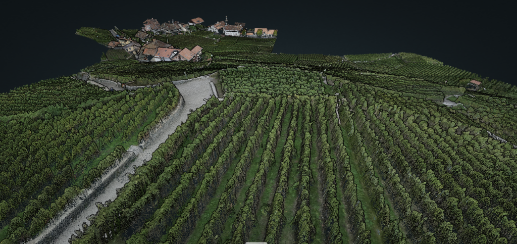
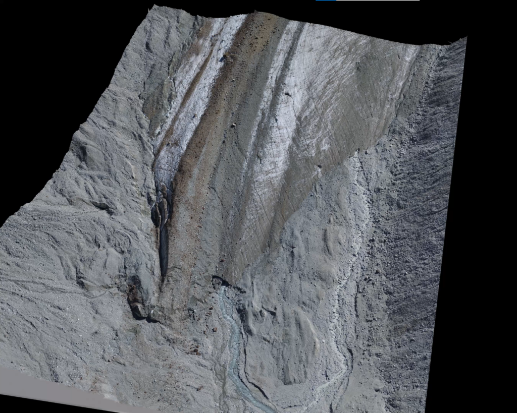
Drones can be invaluable tools for rapid, precise modeling of the territory in a variety of fields, including: mapping a municipal territory, environmental monitoring in general (rivers, glaciers, landslides, etc.), monitoring a construction site or gravel pit, or mapping for precise measurements of distances, surfaces or locations.
Our models are geo-referenced with control points measured to centimeter accuracy using GNSS/RTK antennas.
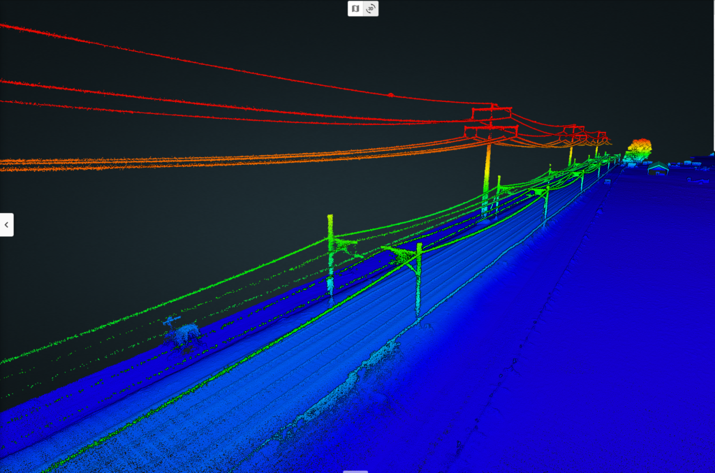
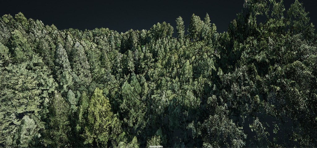
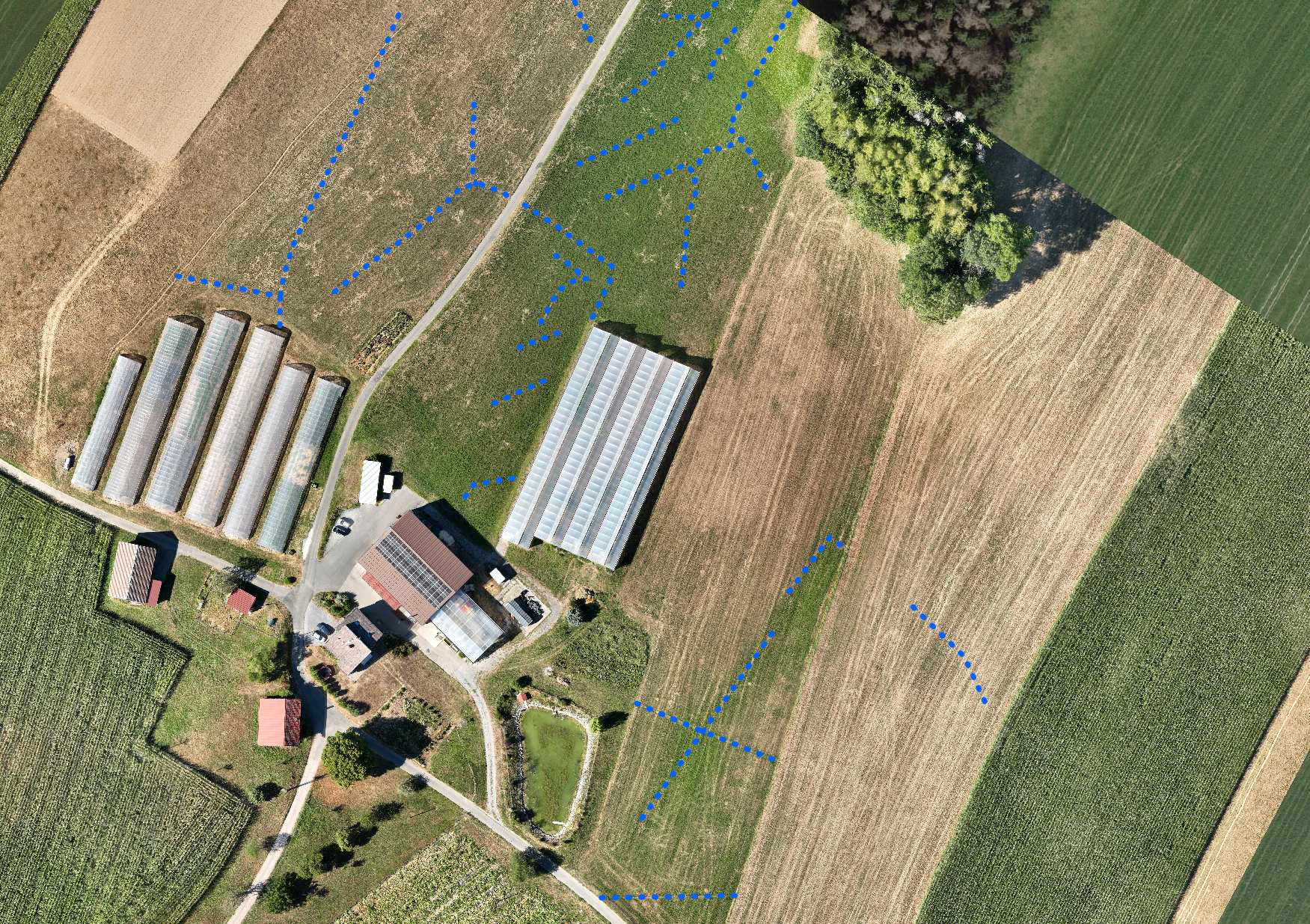
Output formats include orthomosaics, point clouds and digital surface models. LiDAR has the ability to create be able to create digital terrain models (DTMs) in vegetated areas.
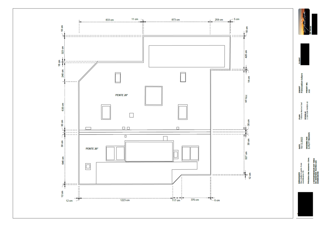
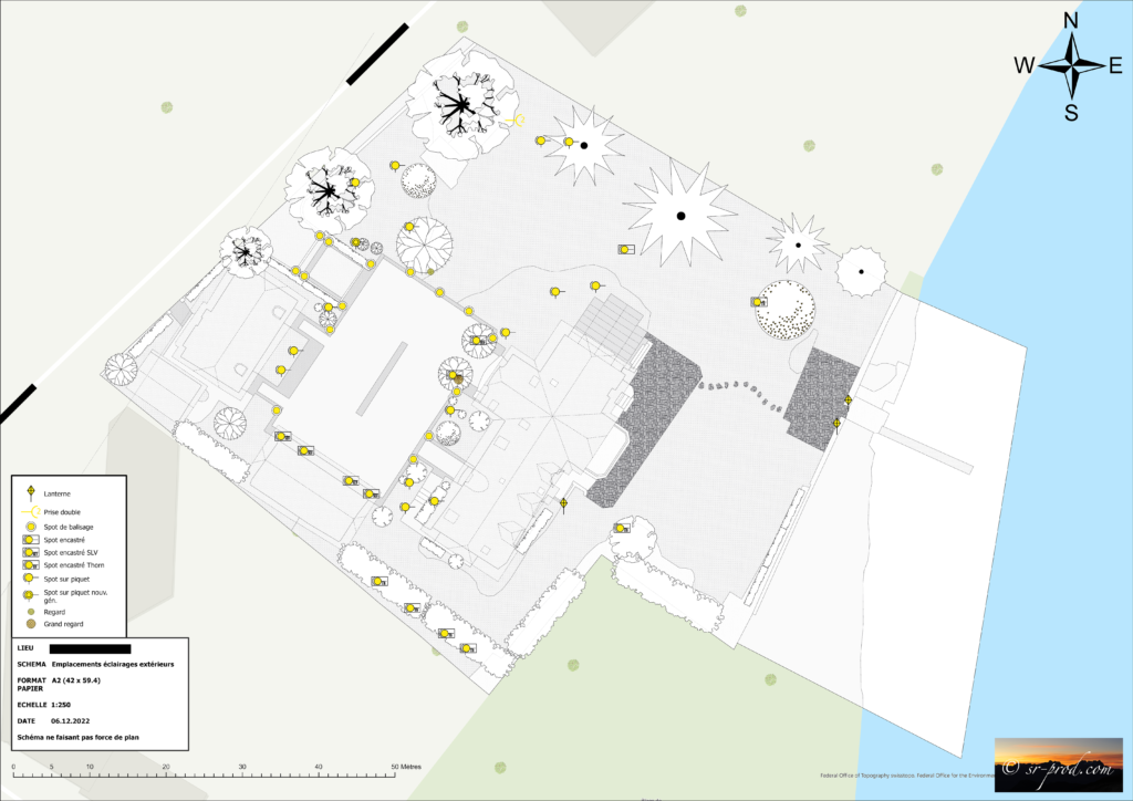
More advanced data processing enables us to create maps, plans and measurements surveys based on the models. We use professional equipment for high-precision data acquisition: Matrice 300RTK, Zenmuse P1, GNSS/RTK Emlid Reach RS2, LiDAR Rockrobotic R2A, Mavic 3 Enterprise.
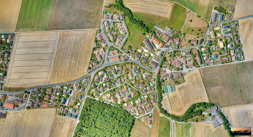
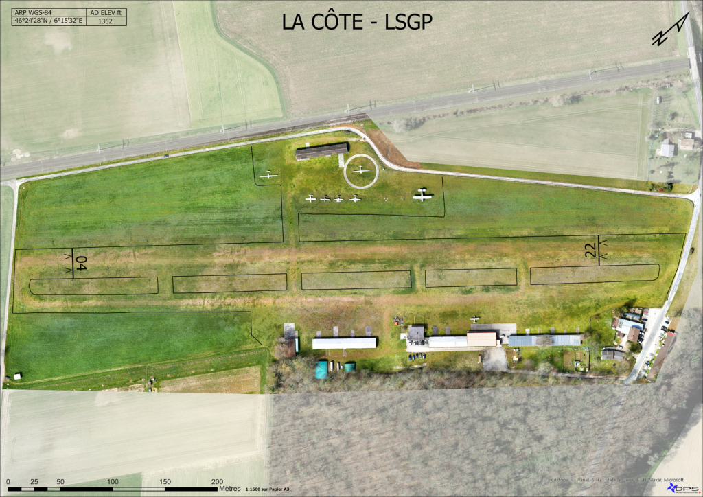
Mapping
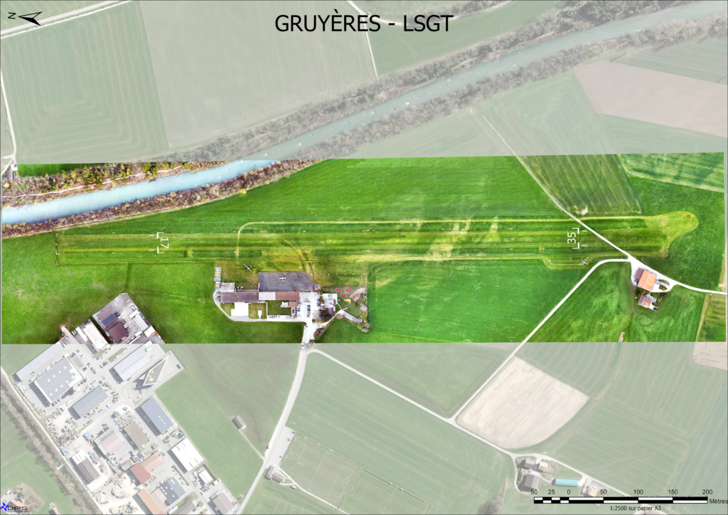
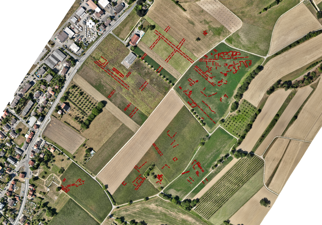
Orthomosaics created with photogrammetry provide an up-to-date view of a large area, such as an entire municipality or town, or of construction sites, and can be used as a basis for land planning or drawing plans.
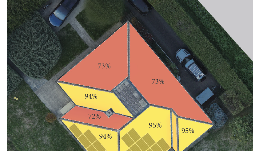
Orthomosaics can also be used for aerial inspection of roads, roofs, solar installations, river evolution, etc.
The drone has several major advantages over conventional aerial imaging: ease of installation, low operating costs and higher measurement resolution. This means that measurements can be repeated over time, for regular, high-precision monitoring.
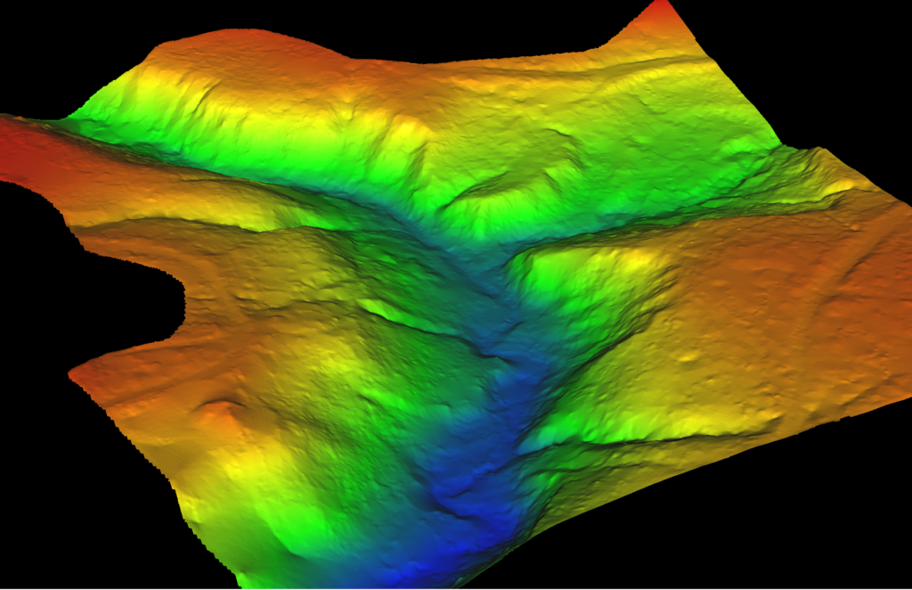
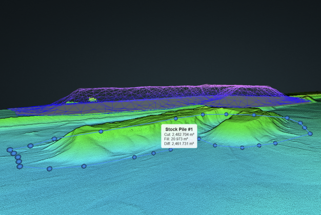
Topography and volumes

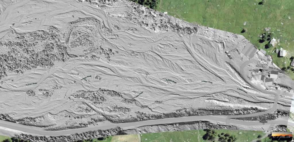
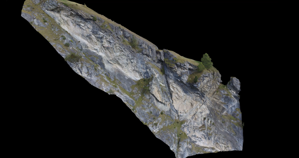
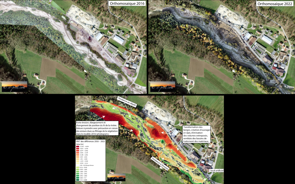
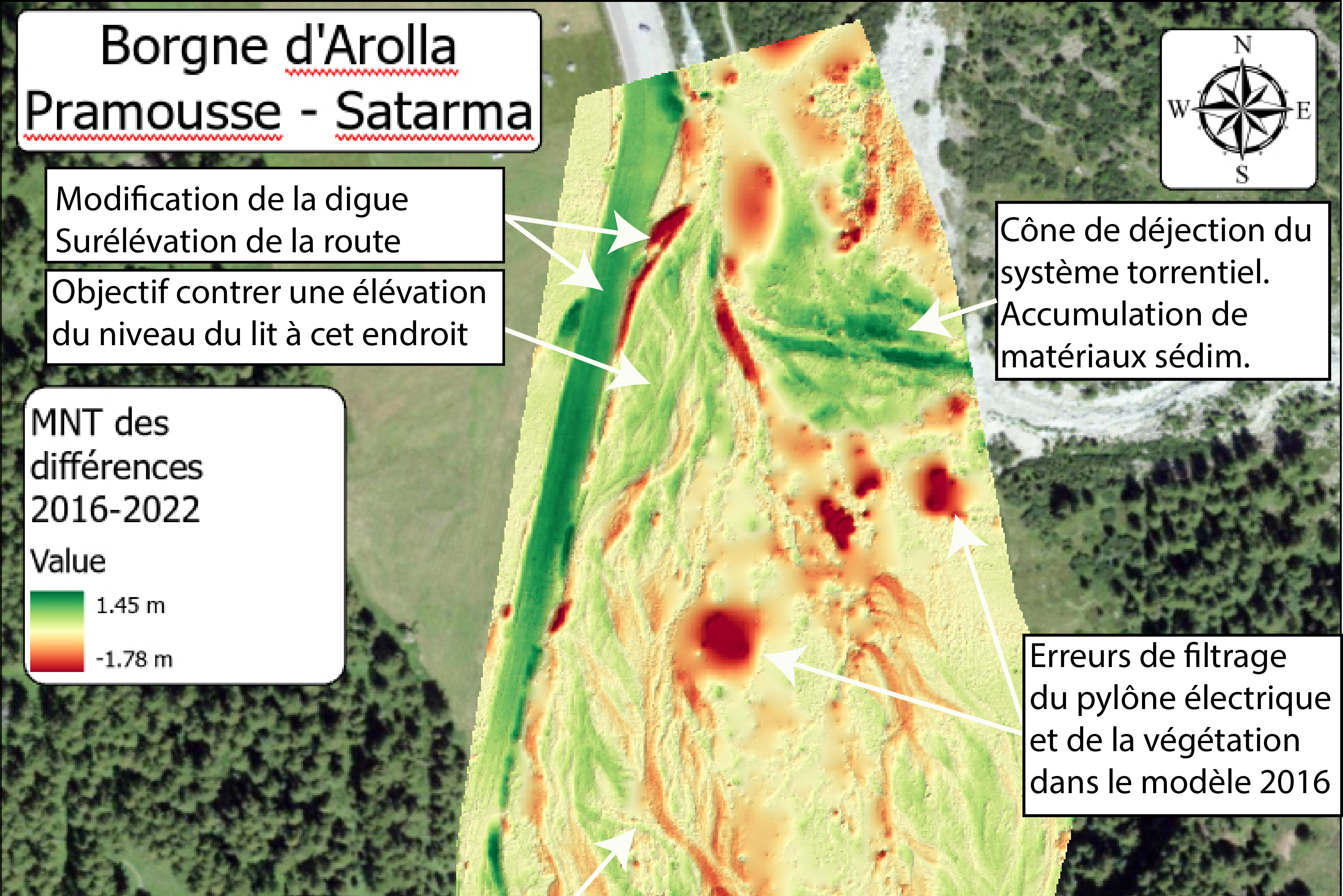
Drone modeling enables to make comparisons of the evolution of a territory at different time intervals and over large areas, with a number of points per square meter unmatched by other terrestrial methods such as GNSS/RTK or Total Station surveying, and a higher resolution than manned aviation.
This technique allows to take precise photogrammetric or LiDAR measurements of changes in the terrain, and to produce what are known as DEMs (Digital Elevation Models) of differences, which can be used to calculate the volumes of these differences, and consequently to determine the volumes eroded/deposited, excavated/repacked, mobilized during landslides, or to measure the volumes of glacier melt, etc.
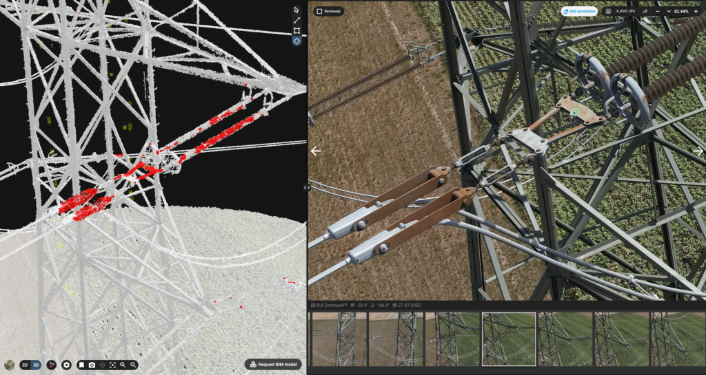
Inspections and measurements
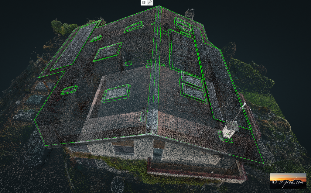
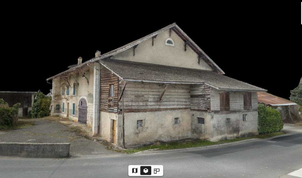
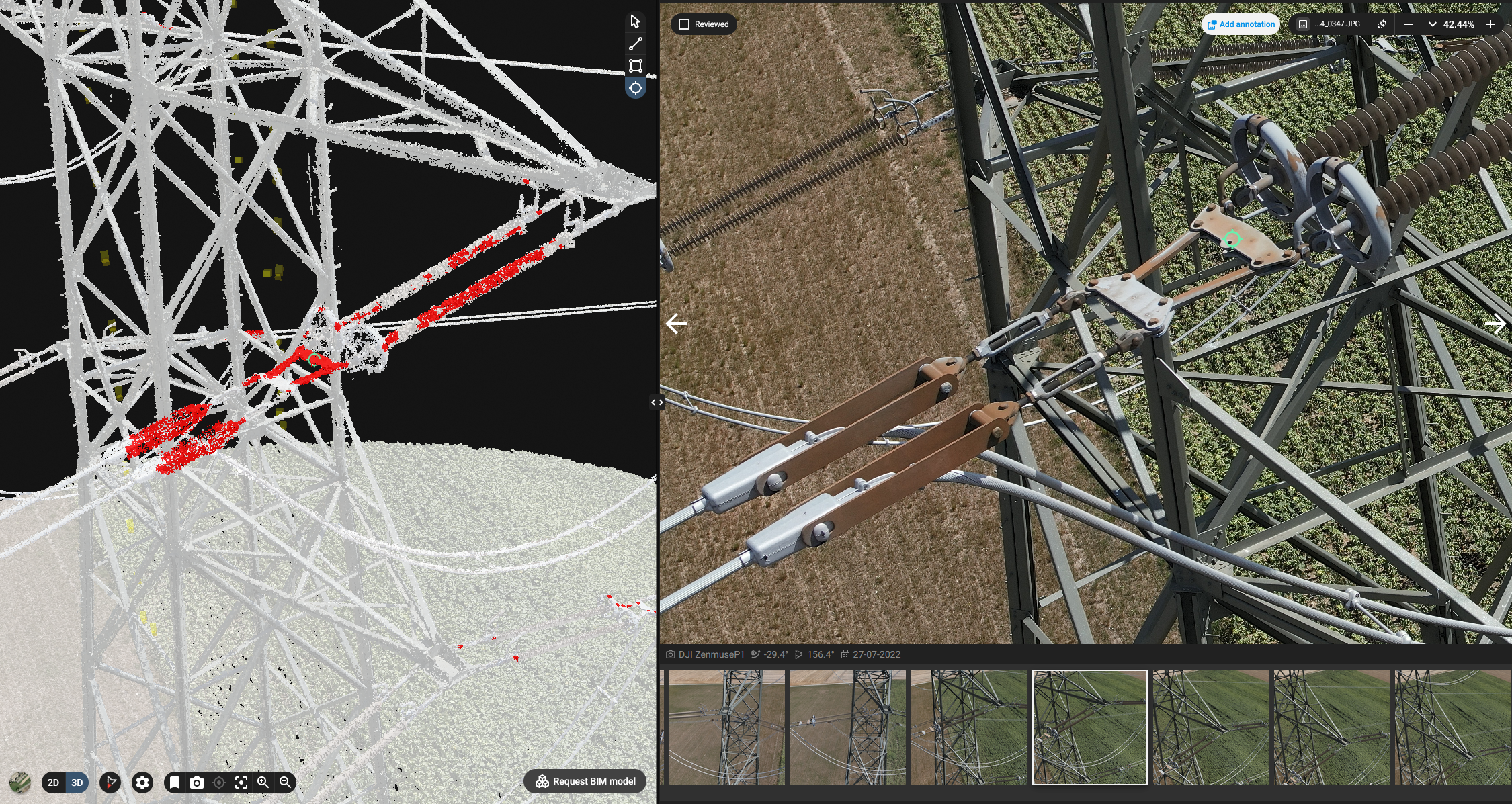
The drone is the ideal tool for inspecting hard-to-reach areas in complete safety, such as facades, roofs, civil engineering structures, bridges and so on.
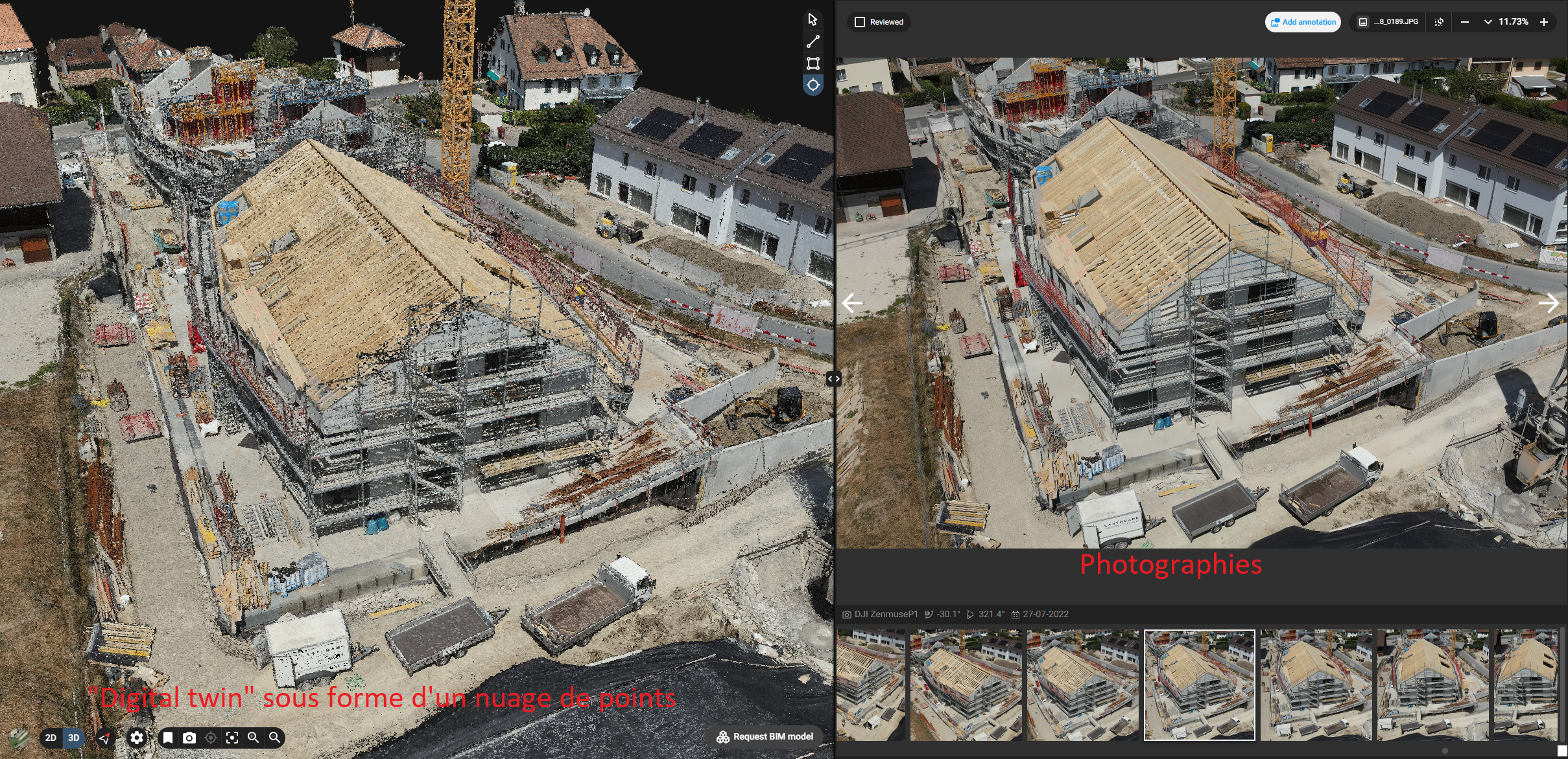
Coupled with high-precision photogrammetry, the drone can rapidly produce a “digital twin” of a structure by capturing several hundreds of photos, which are then processed in specialized software. The model produced can then be visually inspected from all angles and without risk to people in hard-to-reach places, to spot any damage, defects, rust, etc.
Construction follow-up
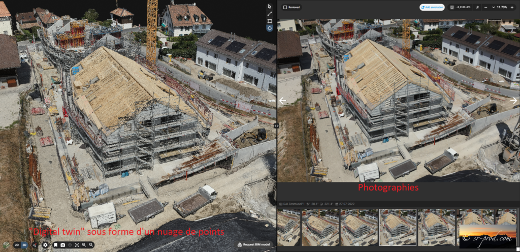
The technique of creating a “digital copy” (or digital twin) by drone, using high-precision photogrammetry or LiDAR, enables all site surveys to be grouped together in a single location in the cloud, and scrolled chronologically in order to monitor the progress of projects of all kinds, such as real estate construction, infrastructure works, site surveys, site monitoring, etc. It also enables models to be easily shared with all project protagonists, helping to improve communication between all parties (developer, architect, commissioned companies, customers, etc.). It also makes it easy to share models with all project stakeholders, helping to improve communication between all parties (developer, architect, contractors, customers, etc.).
Services et projects

Contact US
Photography
Looking for a different perspective?
We provide high quality still images and large panoramas from the ground or using drones and helicopters

360° Virtual tours
Looking for high quality virtual tours for you shop, real estate, or promotion for a region?
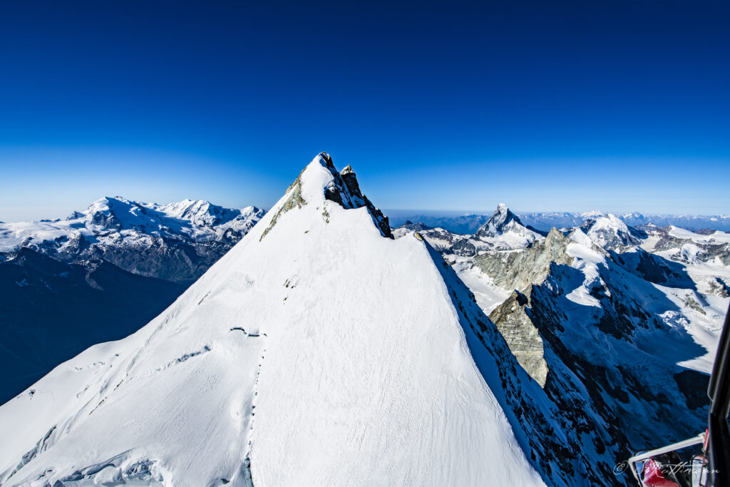
Zermatt